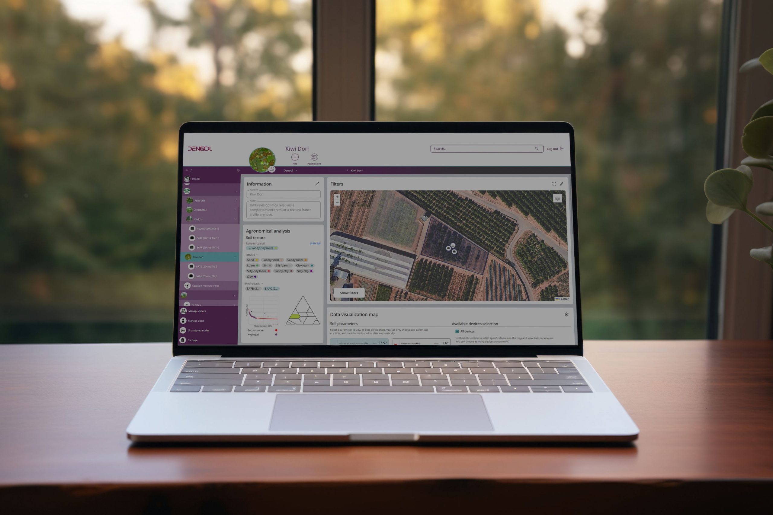
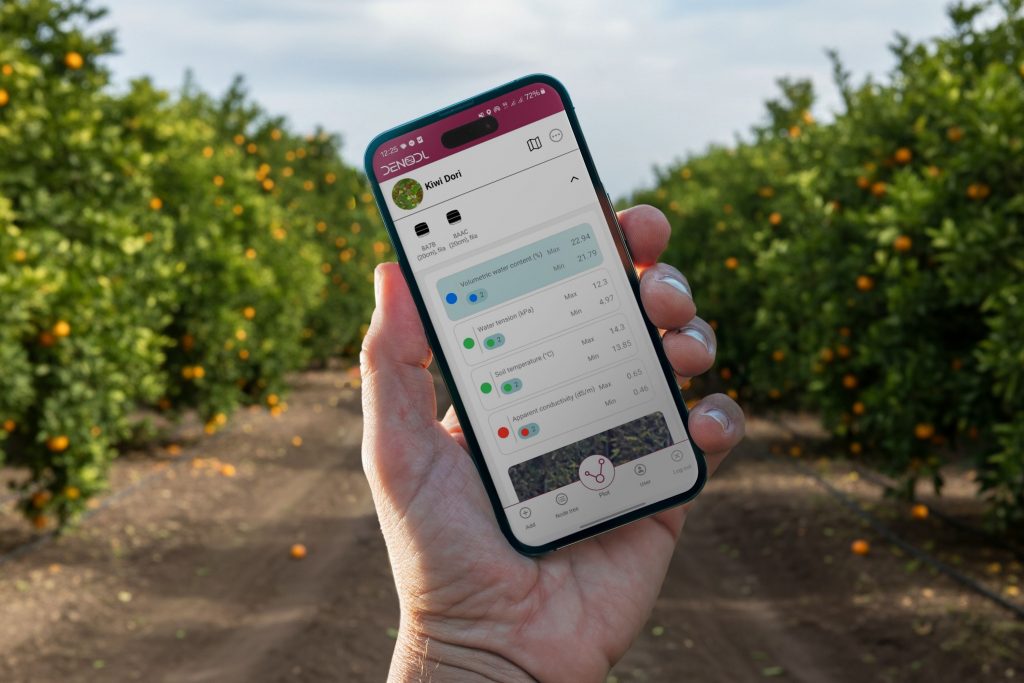

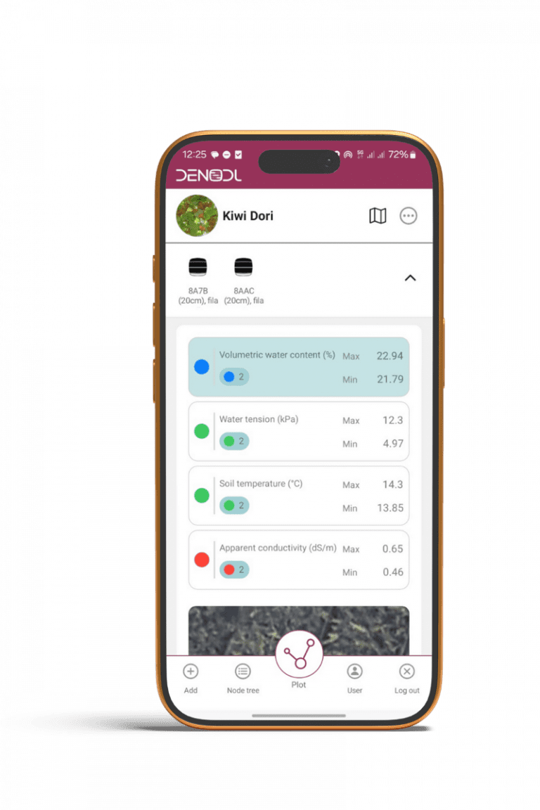
DENODL® App is a SaaS platform for data visualization and management that enables the creation of a digital twin for agricultural operations, smart cities, parks and gardens, golf courses, and other sectors. It includes detailed cartography of the facilities, locating irrigation zones, green areas, and probes, with an intuitive and user-friendly interface.
It stores and displays both historical and real-time data from the probes, integrating other layers of information (such as weather forecasts), and allows for comparison and combination of metrics across sensors. Data can be downloaded for external analysis.
Para ofrecer las mejores experiencias, utilizamos tecnologías como las cookies para almacenar y/o acceder a la información del dispositivo. El consentimiento de estas tecnologías nos permitirá procesar datos como el comportamiento de navegación o las identificaciones únicas en este sitio. No consentir o retirar el consentimiento, puede afectar negativamente a ciertas características y funciones.