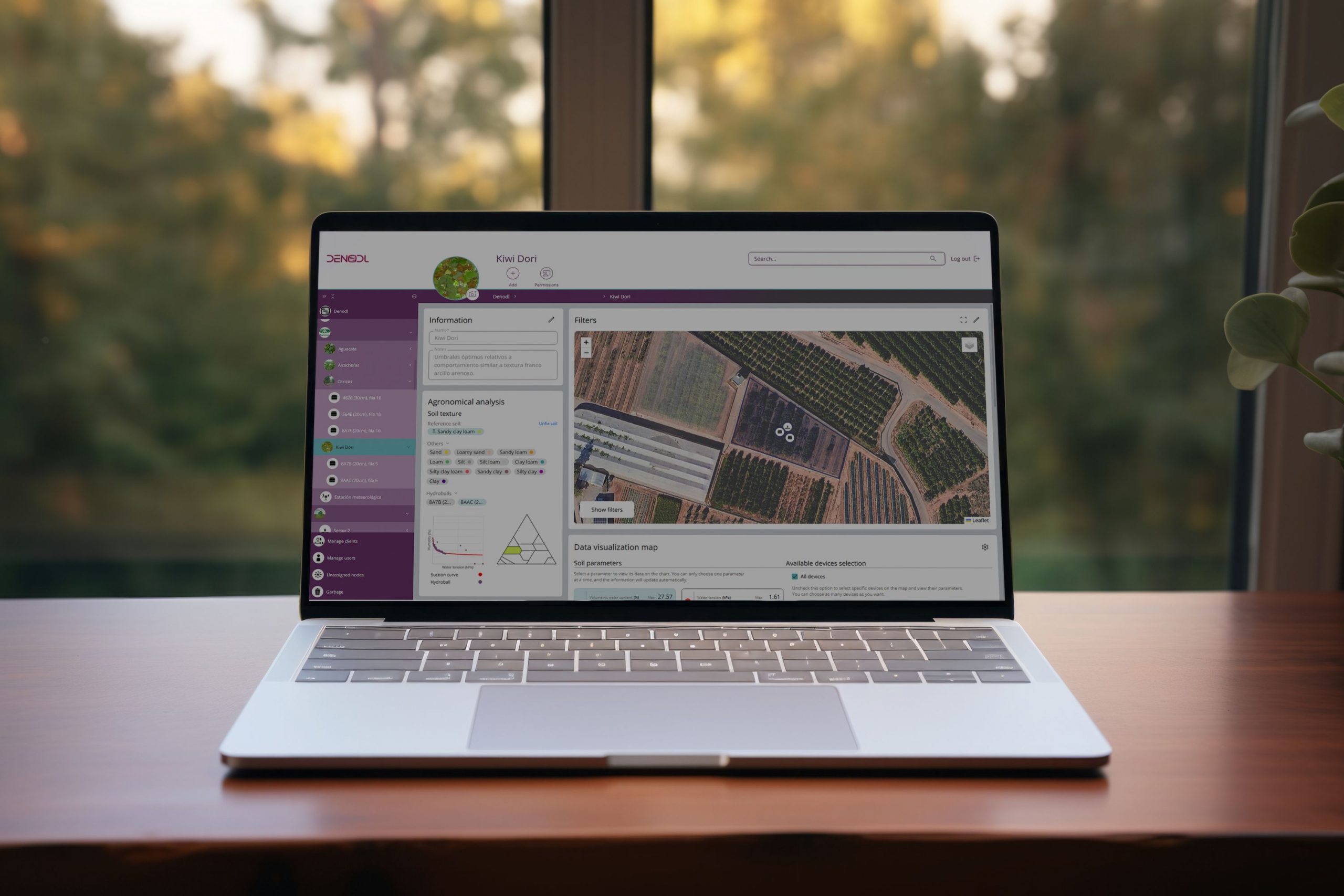

A DENODL® App é uma plataforma SaaS para visualização e gestão de dados que permite a criação de um gémeo digital (digital twin) para operações agrícolas, cidades inteligentes, parques e jardins, campos de golfe e outros setores. Inclui cartografia detalhada das instalações, localizando zonas de irrigação, áreas verdes e sondas, com uma interface intuitiva e amiga do utilizador (ou user-friendly).
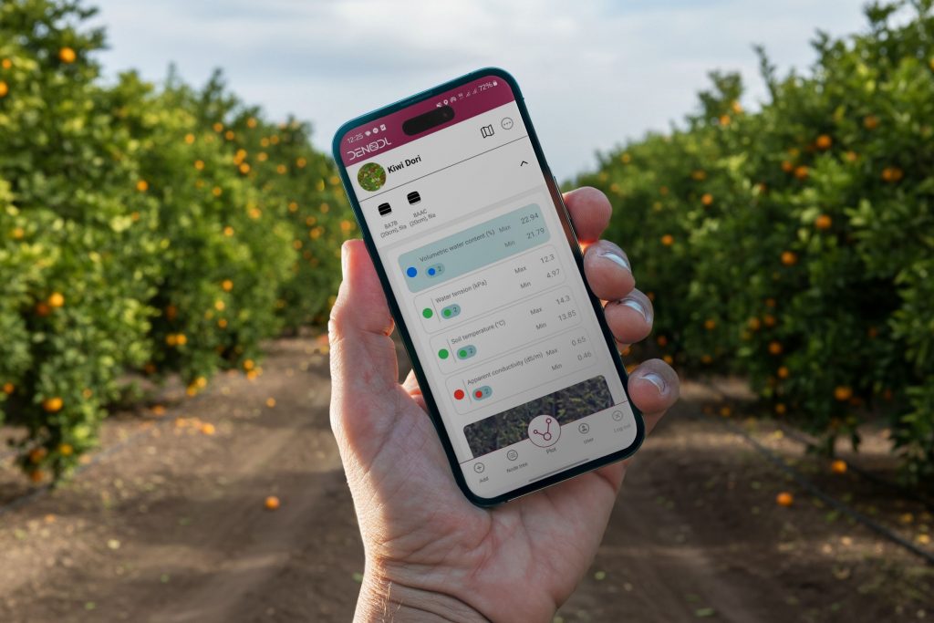
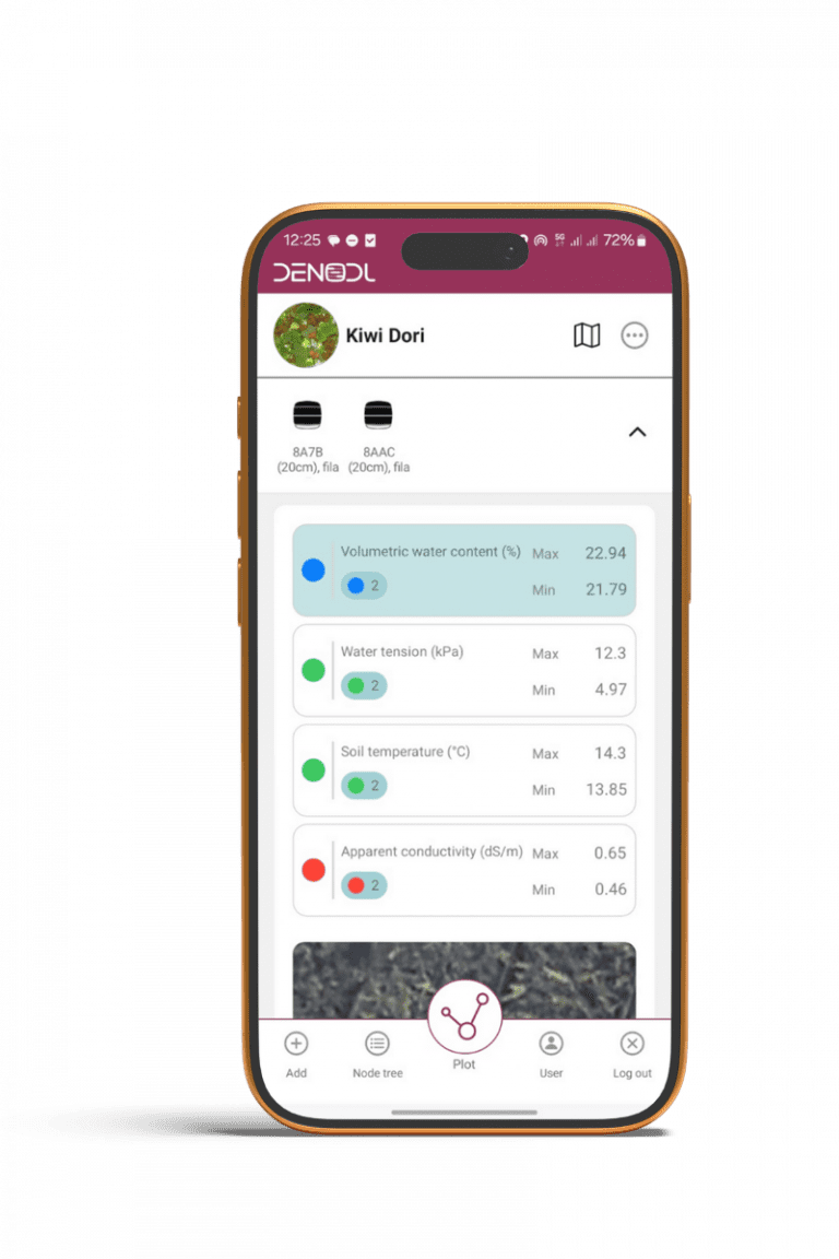
Armazena e exibe dados históricos e em tempo real das sondas, integrando outras camadas de informação (como previsões meteorológicas) e permite a comparação e combinação de métricas entre sensores. Os dados podem ser baixados (ou descarregados) para análise externa.
Para ofrecer las mejores experiencias, utilizamos tecnologías como las cookies para almacenar y/o acceder a la información del dispositivo. El consentimiento de estas tecnologías nos permitirá procesar datos como el comportamiento de navegación o las identificaciones únicas en este sitio. No consentir o retirar el consentimiento, puede afectar negativamente a ciertas características y funciones.